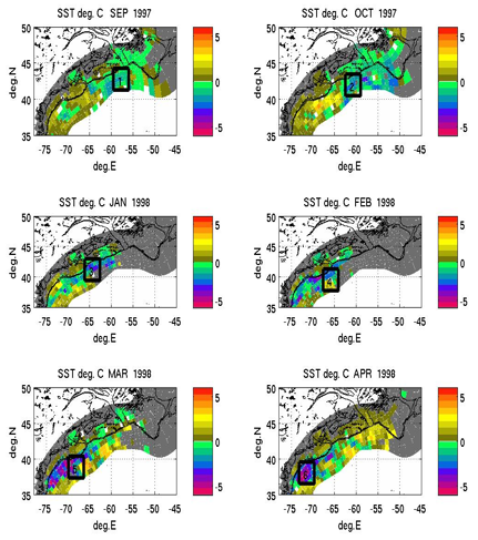
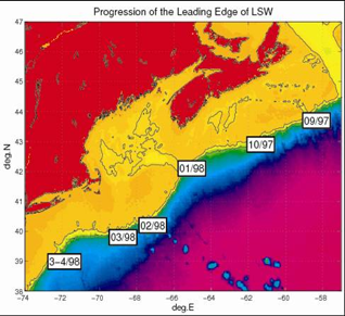
Propagation of the
1997/1998 “Cold Event” in satellite derived SST
•Shipboard measurements were used to track the intrusion
of cold and fresh LSW into the MAB region. Rectangles indicate approximate
timing (month/year) of the leading edge of the LSW intrusion along the
Scotian shelf and northern MAB during 1997-1998. Shown in black are the
coastline, the 200m and 1000m isobaths on the local bathymetry.
•******These results validate that SST is a good way to
track LSW instrusions******
•Dong and Kelly, 2003: shift in winds shifts GS to the
south in 1996, slope sea gyre circulation intensifies.