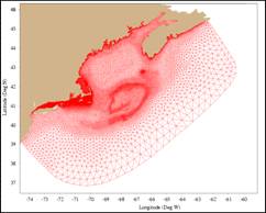
Second Generation
•Horizontal resolution: 0.3-1.0 km in the coastal region;
•Generalized terrain-following
coordinates: 46 layers: 10 uniform layers in the surface and bottom boundary
layers, respectively.
•Capable to nest to the coasta-estuarine model with a horizontal resolution of ~10 -500 m;
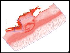
Third Generation
•Horizontal resolution: 0.5-1.0 km in the coastal region;