NOAA R/V ALBATROSS IV
Cruise No. AL 97-12
U.S. GLOBEC Georges Bank
Mooring Cruise
ACKNOWLEDGMENTS
We thank the captain and crew of the R/V ALBATROSS IV for a productive cruise; their professionalism was very much appreciated.
This report was prepared by Ronald Schlitz with assistance from Robert C. Groman. This cruise was sponsored by the National Science Foundation and the National Oceanographic and Atmospheric Administration.
TABLE OF CONTENTS
Cruise Period and Area 3
Objectives 3
Methods 3
Results 4
Disposition of Data 4
Scientific Personnel 4
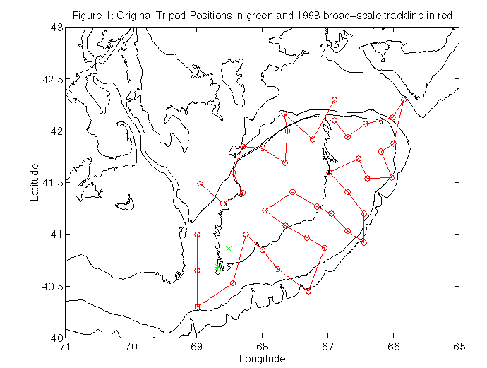
Figure 1: Original Tripod Positions 5
CRUISE RESULTS
Cruise Period and Area
The cruise period was from 3 -7 November 1997. The location was Great South Channel.
Objectives
The major objective was to recover two bottom-mounted tripods and other instrumentation from the GLOBEC moored array. The original positions (see Figure 1) for these elements of the array were:
Positions for Tripods
| Site 4D | 40° 51.73' N | 68° 30.70' W |
| Site 9F | 40° 41.05' N | 68° 40.51' W |
Methods
The recovery was by trawling using standard methods. A Yankee 36 trawl previously used for other operations of this type was utilized.
Results
The following were recovered:
| Site 4D | One tripod missing the ADCP |
| Site 9F | One ADCP, one acoustic release and line cannister, and a tower from a surface buoy but no tripod |
Disposition of Data
The data recovered during this cruise will be merged with the data already recovered from other moorings of the GLOBEC array and analyzed at NEFSC.
Scientific Personnel
National Marine Fisheries Service, NEFSC, Woods Hole, MA
Ronald Schlitz, Chief Scientist
Woods Hole Oceanographic Institution, Woods Hole, MA
Kent Bradshaw
For further information contact: Ronald Schlitz, National Marine Fisheries Service, Northeast Fisheries Science Center, Woods Hole, Massachusetts 02543-1097. Telephone (508) 495-2395.
Figure 1: Original Tripod Positions