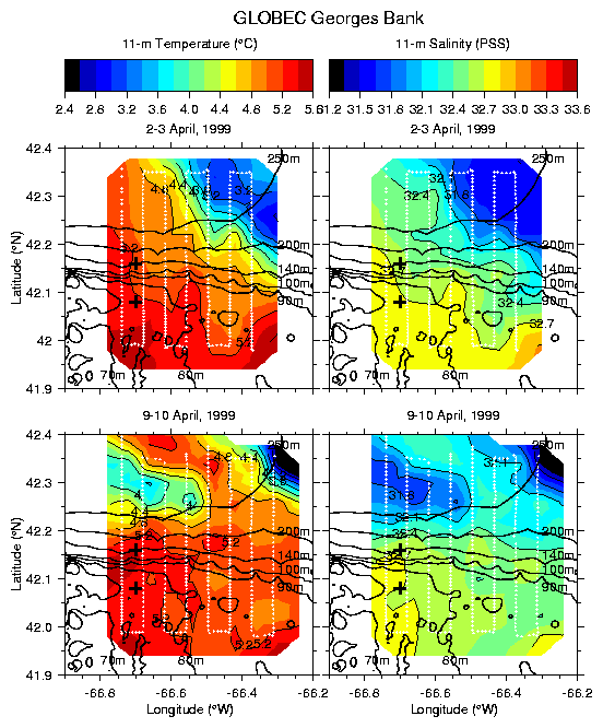
Figure 2. Map of 11 m temperature and salinity from SeaSoar surveys over the northern flank of Georges Bank during 2-3 April and 9-10 April 1999.