CGOA Glider Observations
U.S. GLOBEC NEP will
exploit the capabilities of new, autonomous, telemetering vehicles (Seagliders) to make continuous, high-resolution sections of the ACC. Seagliders measure
temperature, conductivity, pressure, chlorophyll fluorescence, dissolved oxygen and backscatter, profiling from the surface to within 10 m of the shelf bottom
with 2 km horizontal resolution. A Seaglider will be operated year-round, repeating a sampling pattern designed to provide five sections across the ACC every
twenty days. The sampling strategy was designed in coordination with other Long Term Observation Program (LTOP)) investigators to augment existing and
proposed LTOP components. The temporal and spatial resolution provided by Seaglider surveys will resolve processes such as springtime restratification and
phytoplankton blooms, while the multi-year extent of these observations will explore the system's response to long timescale perturbations in forcing.
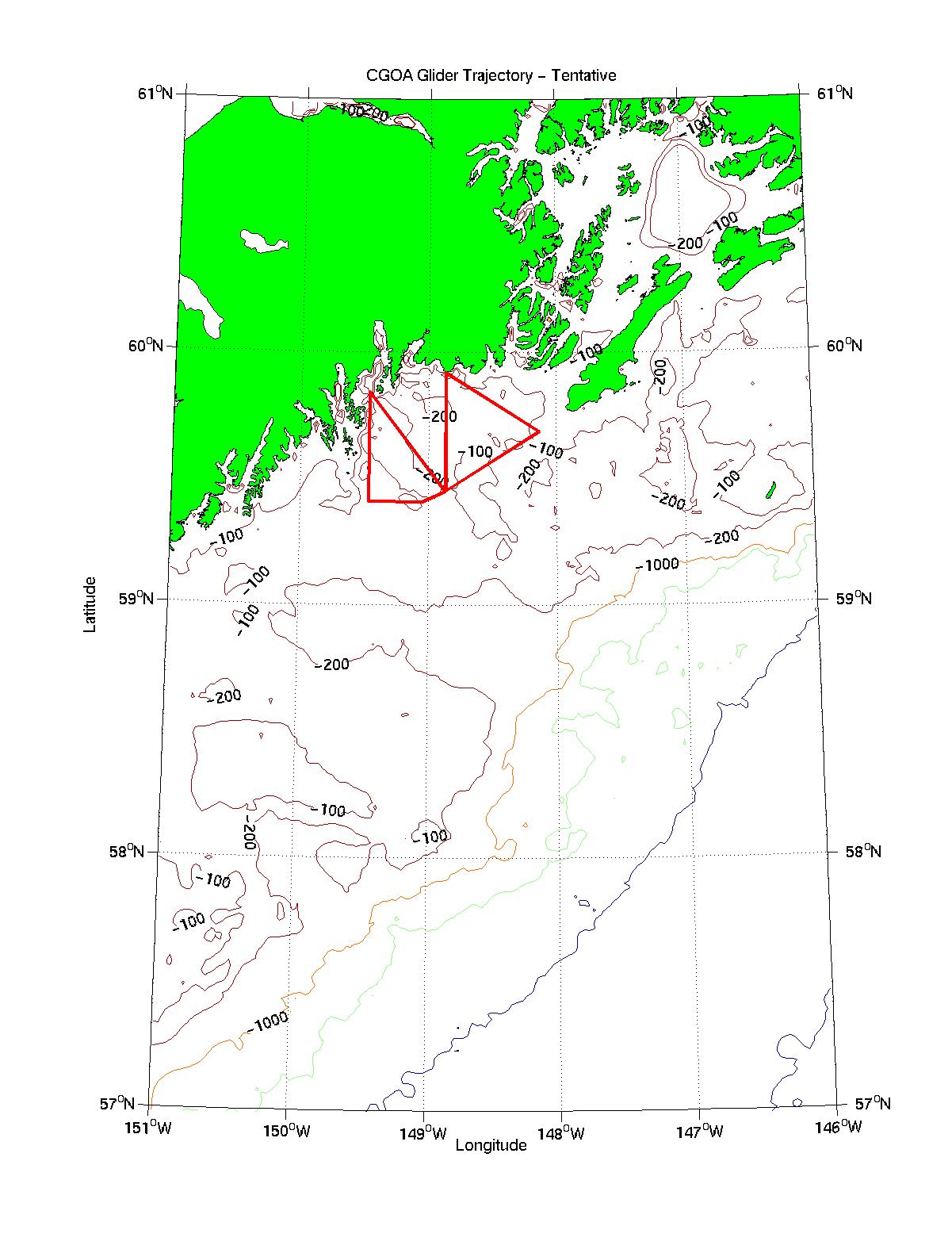
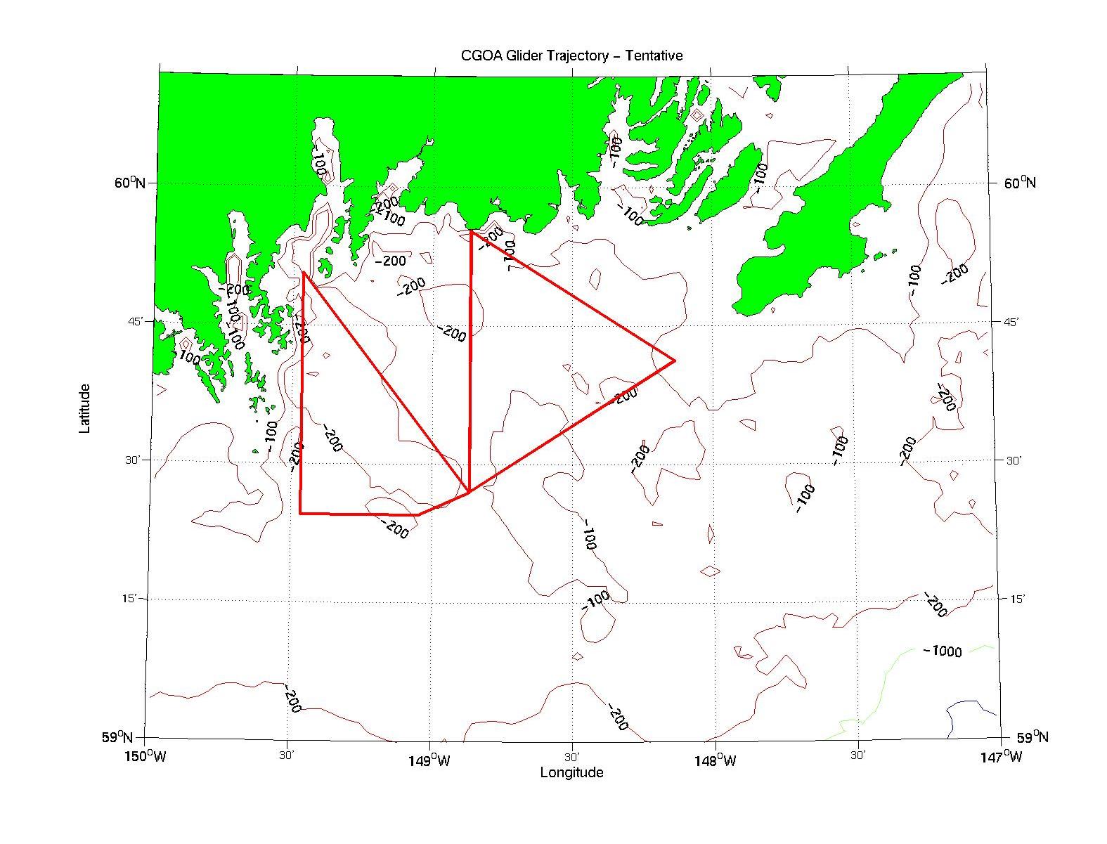
The map below shows one proposed Seaglider trajectory for the shelf region of the CGOA.
The actual trajectory that will be used beginning in July 2001 may differ
slightly from that shown here. The glider requires approx. 21 days
to complete the route shown in the figure below. EPS images of these
large region glider trajectory
and small region glider trajectory maps are available.
Page Maintained by Hal Batchelder
Last Updated: 3 April 2001