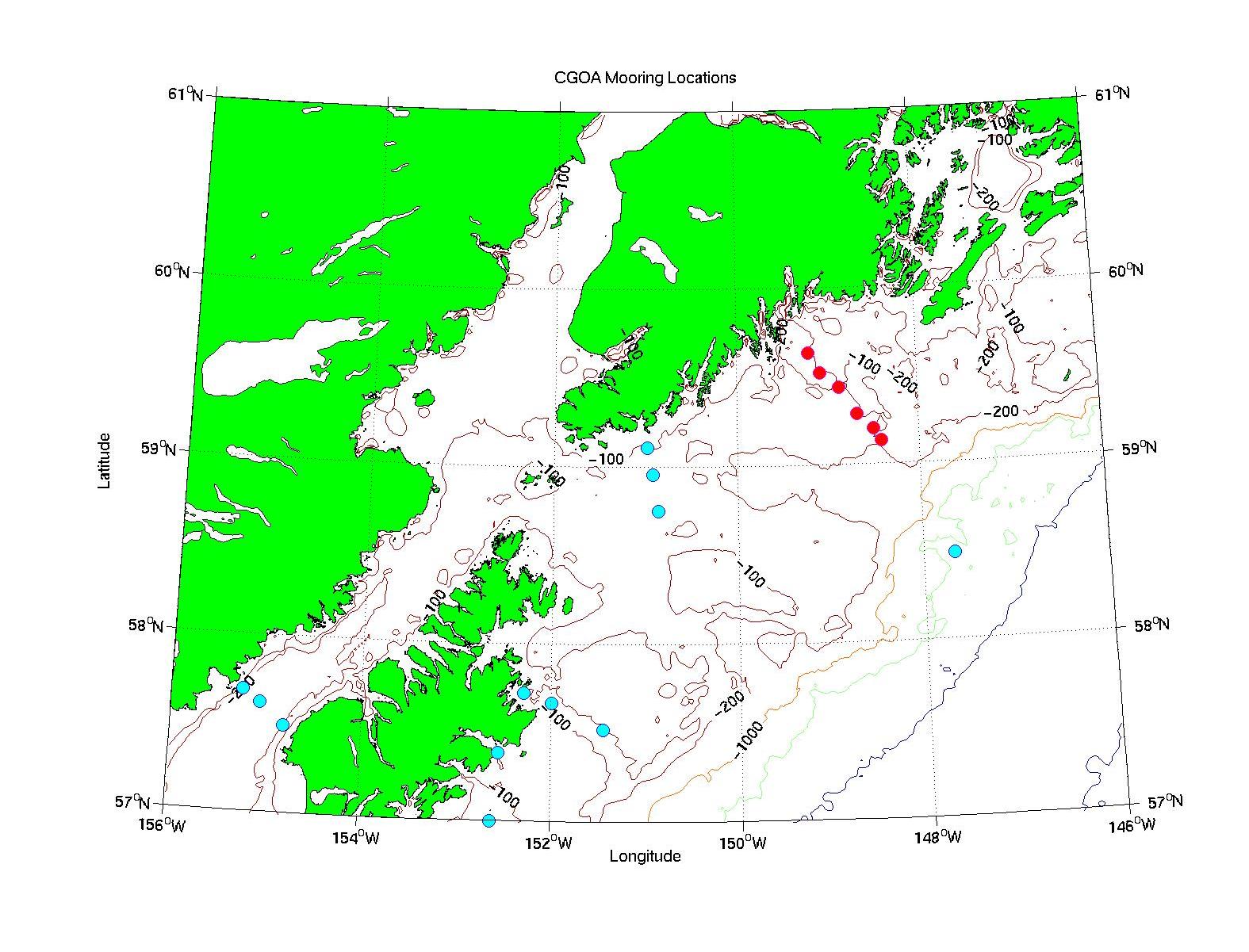
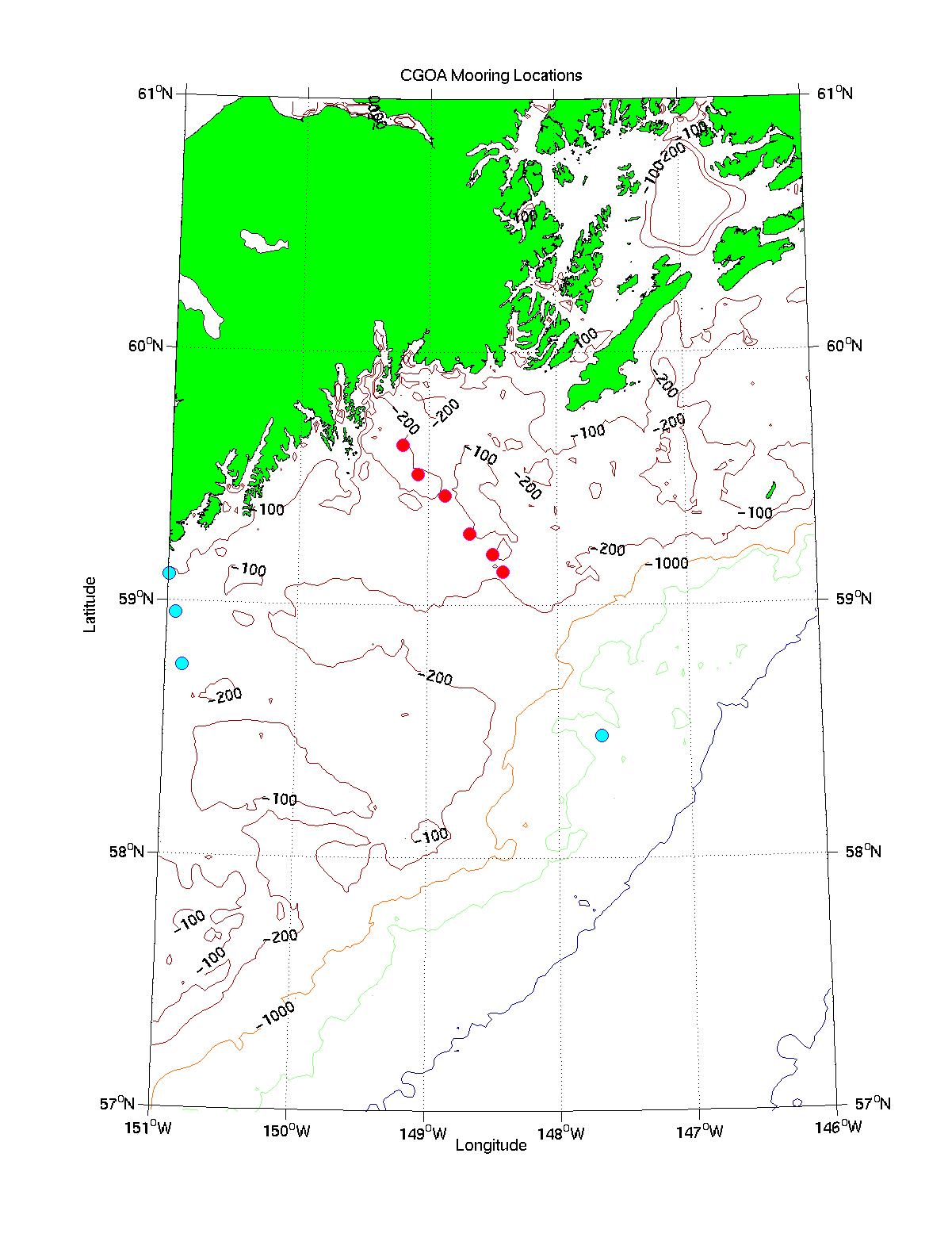
CGOA Moorings
U.S. GLOBEC is funding six moorings to be located near (but not exactly on)
the Seward Line (shown as red circles in figures below). PMEL/FOCI are funding
additional moorings along the Gore Pt. Line to the west of the Seward Line, and
around Kodiak Island (blue cirles). FATE program may fund a mooring at the offshore end
of the Seward Line (blue circle). EPS images of these
large-scale
and small-scale maps are available.
| MOORING ID | LAT | LONG
|
|---|
| F-01P-3S | 57.4892 | -154.81
|
| F-01P-2S | 57.619 | -155.07
|
| F-01P-1S | 57.6857 | -155.25
|
| F-01-32S | 59.1057 | -150.99
|
| F-01-34S | 58.955 | -150.93
|
| F-0P-36S | 58.75 | -150.87
|
| 01CB-1D | 57.7215 | -152.29
|
| 01CB-2S | 57.6667 | -152
|
| 01CB-3S | 57.5167 | -151.45
|
| 01UB-1S | 57.3833 | -152.55
|
| 01BC-1S | 57.000 | -152.63
|
| 01FATE-M1 | 58.4833 | -147.67
|
| 01-GB-6S | 59.1333 | -148.42
|
| 01-GB-5S | 59.2 | -148.5
|
| 01-GB-4S | 59.2833 | -148.68
|
| 01-GB-3S | 59.4333 | -148.87
|
| 01-GB-2S | 59.5167 | -149.08
|
| 01-GB-1S | 59.6333 | -149.2
|
Page Maintained by Hal Batchelder
Last Updated: 3 April 2001