|

Home
Background
Schedule
Daily Log
Technology
Video
Classroom
Exercise
__________
GLOBEC NEP
U.S.
GLOBEC
GLOBEC
International
__________
|
|
|
GLOBEC Northeast Pacific Program Mapping of Physical and
Biological Fields in the Northern California Current July 31 - August 19,
2002 |
 |
Argos
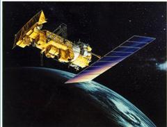
Argos is a satellite-based location and data collection system
dedicated to monitoring and protecting the environment.
Argos is able to locate any platform equipped with a suitable
transmitter, anywhere in the world, to within 150 to 1000 meters
(using Doppler effect). It can also collect data from sensors
connected to the transmitter. Over 7 thousand Argos transmitters are
now operating around the world. The satellites collect the data
and retransmit it to the Argos centers for processing.
Scientists can retrieve the results from anywhere in the world by
public data networks, often within 20 minutes of transmission.
The Argos system has been operational since 1978. It was established
under an agreement (Memorandum of Understanding) between the National
Oceanic and Atmospheric Administration (NOAA, USA), the National
Aeronautics and Space Administration (NASA, USA) and the French Space
Agency (CNES).
|
This page was last updated on
July 30, 2002 04:04 AM |


